Understand
We begin with the decision or problem that needs to be addressed — not with a software choice or a dataset. What has to be decided, by whom, and on what evidence?
Home / Approach
Our ApproachGood geospatial work is not a sequence of tools — it is a chain of decisions about data, method and interpretation, each of which has to hold. This is how we structure that chain.
We begin with the decision or problem that needs to be addressed — not with a software choice or a dataset. What has to be decided, by whom, and on what evidence?
We identify the appropriate data, methodology, modelling framework and technology, and state the assumptions and limitations up front rather than discovering them at the end.
We process and analyse spatial, environmental and Earth observation data using rigorous geospatial workflows — scripted wherever repetition or reproducibility demands it.
Outputs are reviewed through systematic quality-control procedures and, where possible, against appropriate reference information, field data or independent datasets.
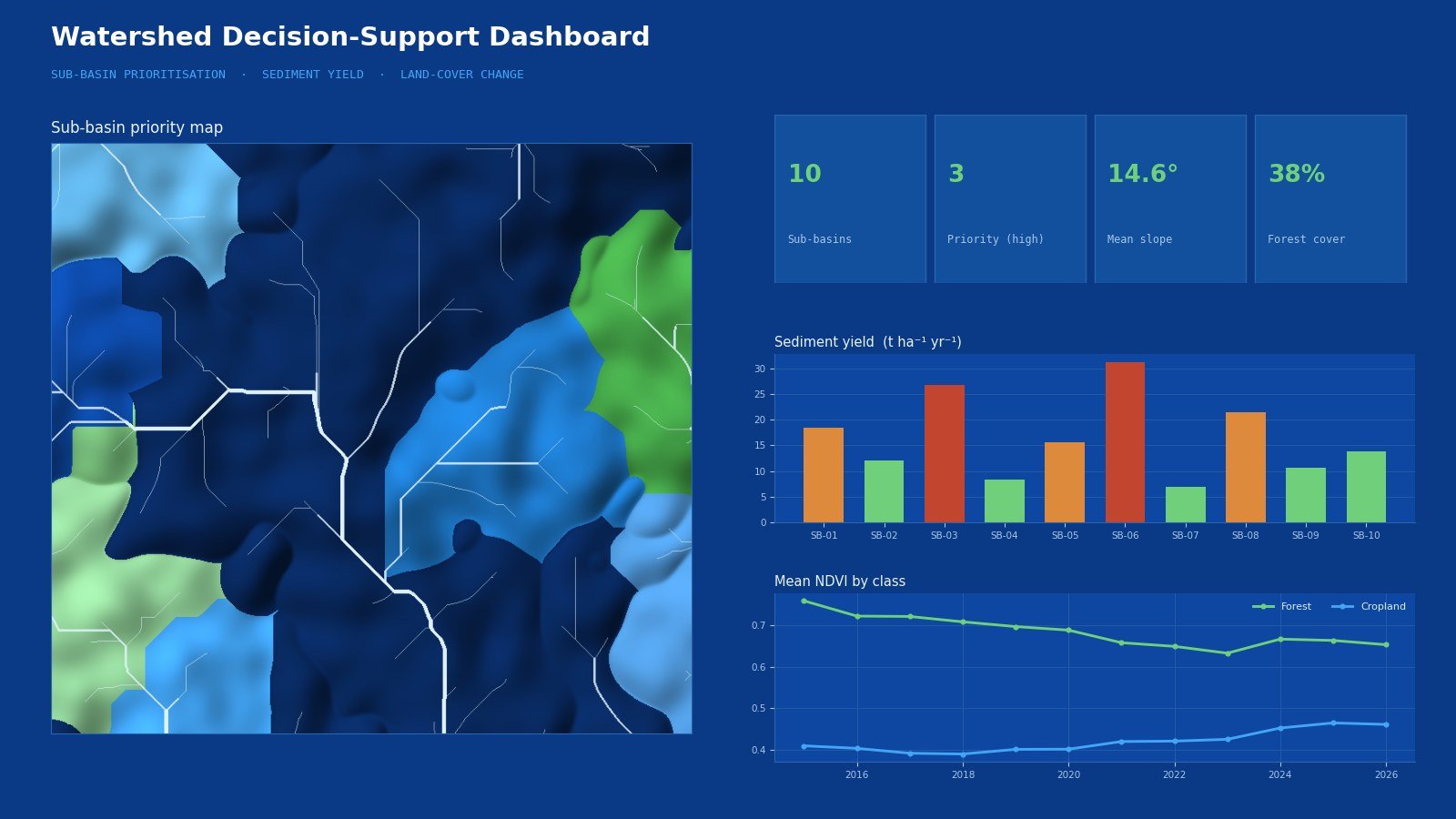
Complex analytical results are translated into clear maps, dashboards, reports and decision-support information that a non-specialist audience can act on.
We provide practical outputs designed for continued use — editable data, documented methods and re-runnable scripts — not simply presentation material.
A project that ends with a PDF is a project that has to be repeated from scratch next year. Where the engagement calls for it, we hand over the working parts as well as the findings.
Our workflows can integrate leading commercial and open-source geospatial technologies, programming environments and modelling frameworks. The tool follows the problem — never the other way round.
Software names are the property of their respective owners and are listed to describe technical capability only.
No — that is usually the best time. The first stage of our process is defining the decision that needs support. It is far cheaper to shape the analytical question properly at the start than to redo the analysis once the scope becomes clear.
It depends on the project. Many analyses can be built entirely from open datasets — satellite imagery, DEMs, global land-cover and climate products. Where you hold local data (field surveys, cadastral layers, monitoring records, model outputs), it usually improves accuracy, and we will tell you clearly what would make the biggest difference.
Yes. We deliver in the formats and coordinate systems your team already uses — file geodatabases, shapefiles, GeoPackage, PostGIS, GeoTIFF, ArcGIS Online items — and we can script workflows to run inside either ArcGIS Pro or QGIS.
Where the engagement includes it, yes. Automation is a core part of what we do: scripted workflows, documented parameters and re-runnable tools mean the analysis can be repeated when new data arrives, without commissioning the work again.
Yes. Data-handling terms, storage arrangements and non-disclosure requirements can be agreed before any data is transferred. Sensitive datasets are processed only for the agreed purpose and returned or destroyed on request.
Most work is quoted as a fixed price against a defined scope and deliverable list, once the objective and data situation are clear. Longer programmes and team-integration engagements can be arranged on a retained or time-based basis.
Send us the decision you need to make and whatever data you already hold. We will come back with a proposed methodology, the data it would need, and an honest view of what it can and cannot tell you.